
IBONES DE GORGUTES Y PUERTO DE LA GLERA-BENASQUE
Trail photos


Author

Trail stats
- Distance
- 4.47 mi
- Elevation gain
- 1,880 ft
- Technical difficulty
- Easy
- Elevation loss
- 1,880 ft
- Max elevation
- 7,758 ft
- TrailRank
- 62
- Min elevation
- 5,858 ft
- Trail type
- Loop
- Time
- 4 hours 47 minutes
- Coordinates
- 984
- Uploaded
- July 17, 2023
- Recorded
- July 2023
near Era Bordeta, Catalogne (Espagne)
Viewed 2103 times, downloaded 71 times
Trail photos
Itinerary description
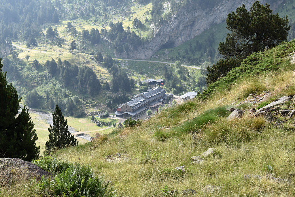
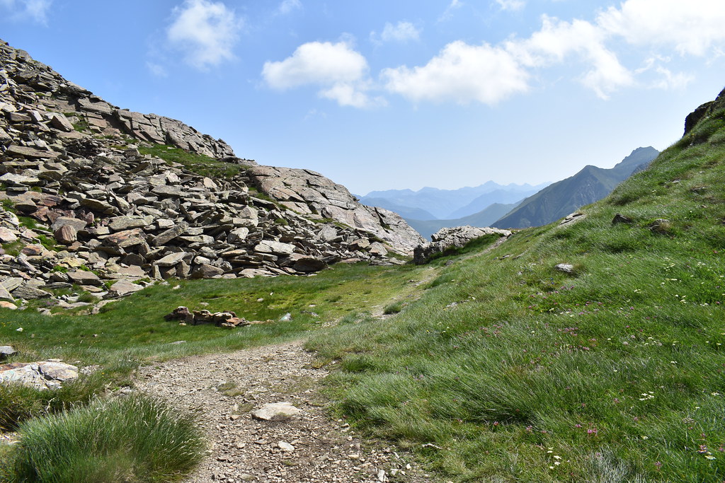
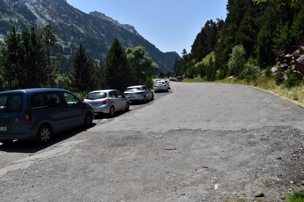
Para llegar al punto de inicio, coger en Benasque dirección hacia Llanos del Hospital. Se tarda unos 15 minutos. Cuando llegas al desvío a la derecha para bajar a los Llanos, lo dejas, sigues recto y llegas en un momento. Seguramente pasarás por delante de coches que han aparcado para subir a los ibones de Remuñe, no te confundas y sigue adelante. No tiene pérdida porque la carretera termina ahí. Se aparca al borde de la carretera.
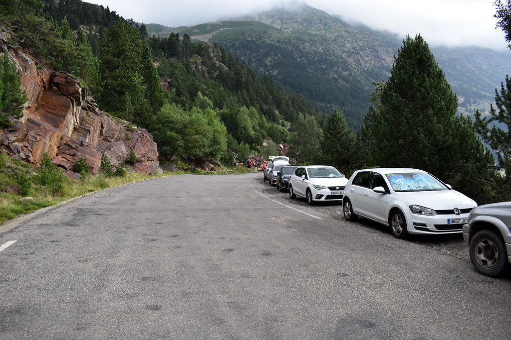
Dejamos el coche al final, donde termina la carretera, en el borde. Si te fijas, al fondo se ven los carteles de la carretera cortada.
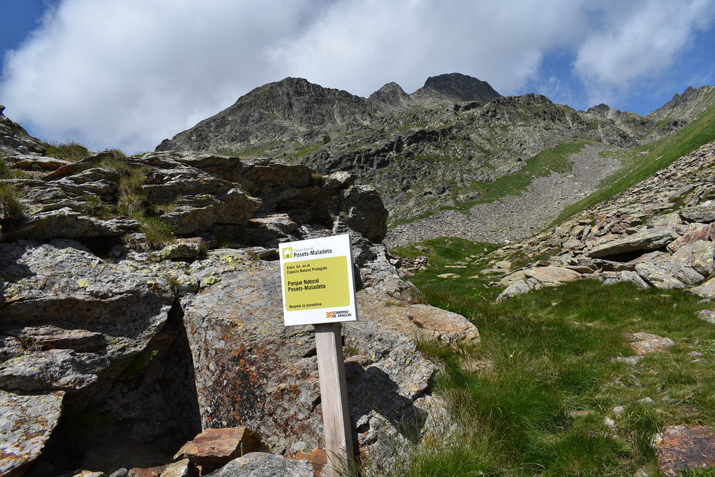
El cartel que no te despiste, aunque marque ir recto, el camino sube por la izquierda. Nosotros a paso tranquilo, tardamos 1 45 al ibón, y 2 horas al Puerto de la Glera.

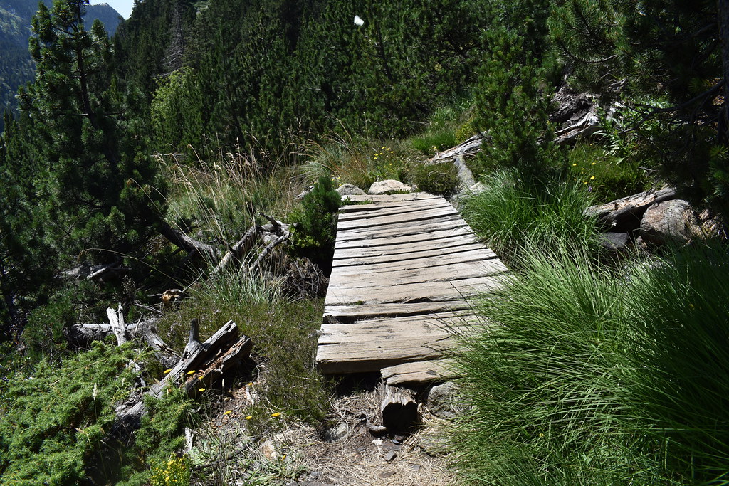
Cruzamos el puente.
Nosotros hacia el ibón.

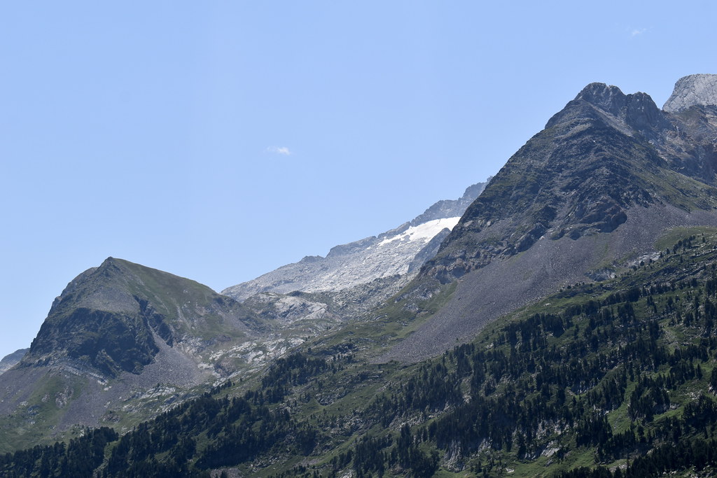
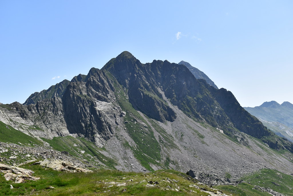
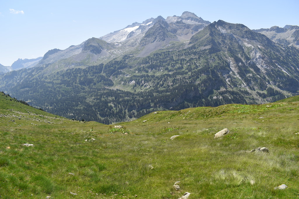
Se empieza a ver el glaciar. Estas fotos son por la tarde, a la mañana estaba cerrado por las nubes. Pero luego veremos el glaciar perfectamente.

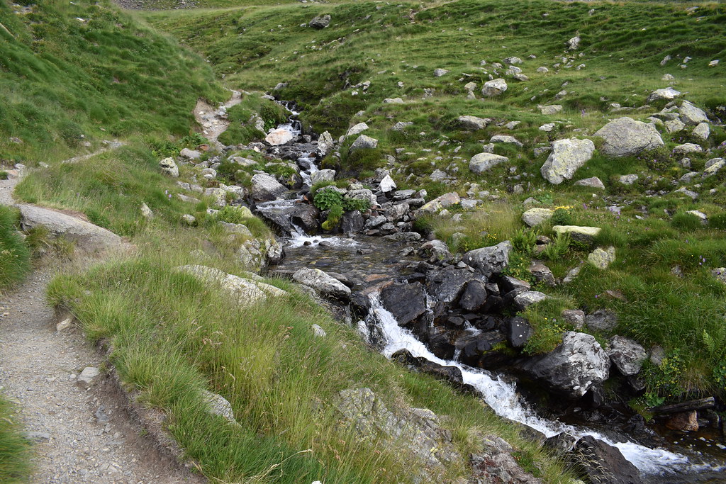
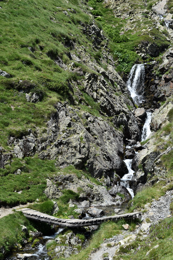
Cascadas, esta zona baja con mucha agua..


Y llegamos al puente, lo cruzamos.


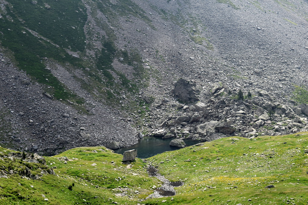
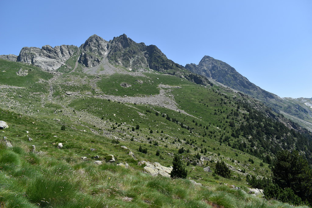
Ibones de la solana de Gorgutes. Los dejamos a nuestra derecha, para la vuelta.

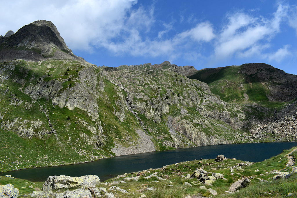
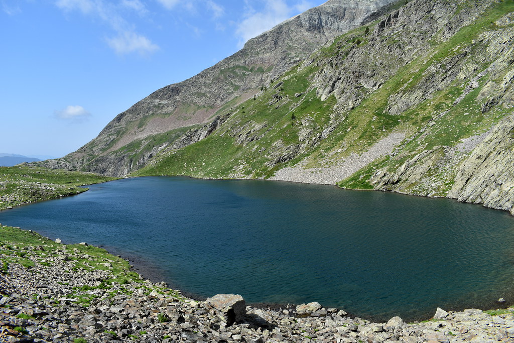
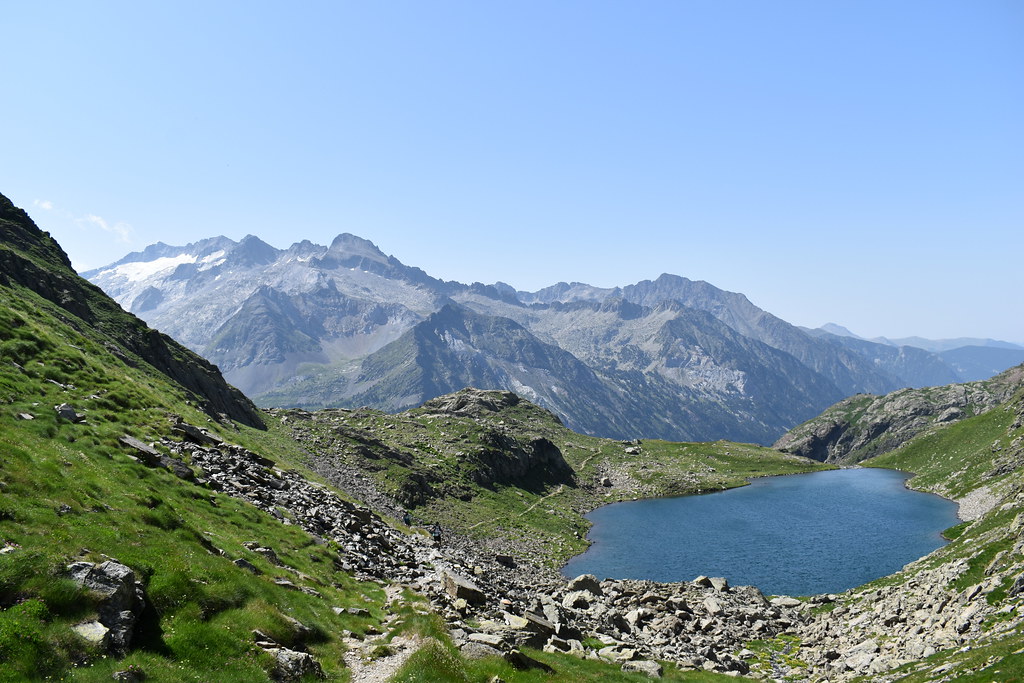
Y llegamos al ibón de Gorgutes.

Subimos hacia el puerto de La Glera. Son unos 15-20 minutos y merece la pena, tanto las vistas del lado francés como la vista del ibón desde arriba.


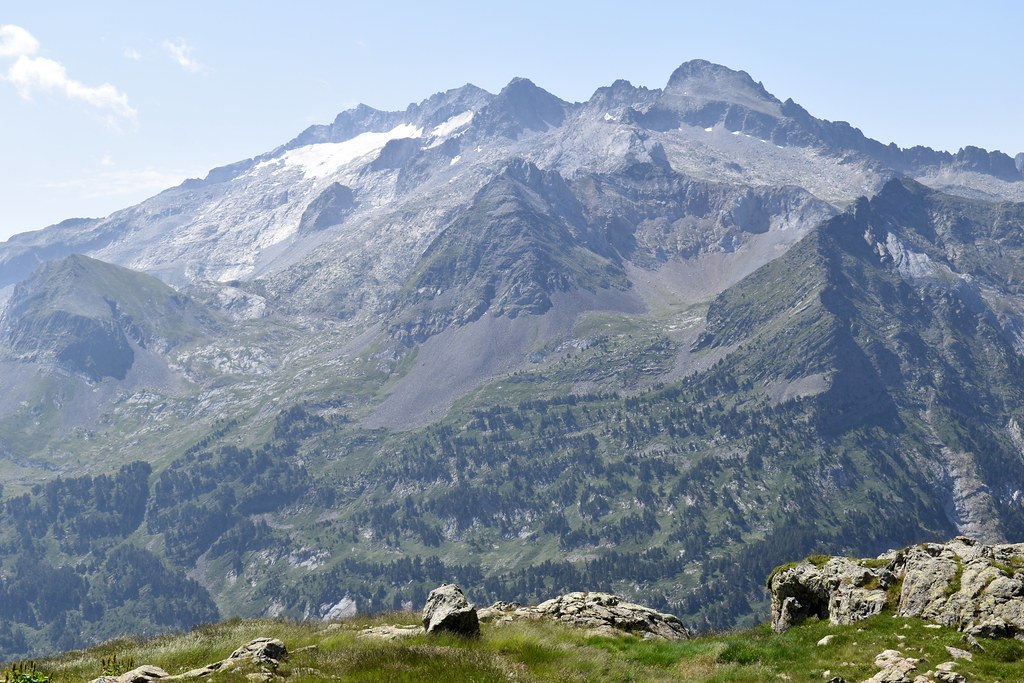
El Aneto y su glaciar.

Ya casi estamos.
Y llegamos.


La Muga 33.


Descanso para fotos, tomar algo... y nos volvemos. Ahora disfrutaremos con la vista del ibón, el Aneto...

Zoom al glaciar.

Y dejamos el ibón.

Vaya vistas...

Hacia el ibón de Solana de Gorgutes, mucho más pequeño pero me acerco para hacer unas fotos.


Y vuelvo al camino de subida, porque está rodeado de grandes bloques de piedras y está incómodo.

Otro zoom al glaciar.

Más cascadas.


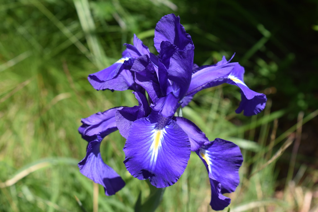
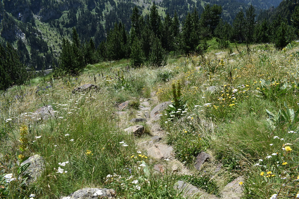
El camino está lleno de flores. Toda esta parte se disfruta mucho.

Y poco a poco llegamos de nuevo al parking.
Dejamos el coche al final, donde termina la carretera, en el borde. Si te fijas, al fondo se ven los carteles de la carretera cortada.
El cartel que no te despiste, aunque marque ir recto, el camino sube por la izquierda. Nosotros a paso tranquilo, tardamos 1 45 al ibón, y 2 horas al Puerto de la Glera.
Cruzamos el puente.
Nosotros hacia el ibón.
Se empieza a ver el glaciar. Estas fotos son por la tarde, a la mañana estaba cerrado por las nubes. Pero luego veremos el glaciar perfectamente.
Cascadas, esta zona baja con mucha agua..
Y llegamos al puente, lo cruzamos.
Ibones de la solana de Gorgutes. Los dejamos a nuestra derecha, para la vuelta.
Y llegamos al ibón de Gorgutes.
Subimos hacia el puerto de La Glera. Son unos 15-20 minutos y merece la pena, tanto las vistas del lado francés como la vista del ibón desde arriba.
El Aneto y su glaciar.
Ya casi estamos.
Y llegamos.
La Muga 33.
Descanso para fotos, tomar algo... y nos volvemos. Ahora disfrutaremos con la vista del ibón, el Aneto...
Zoom al glaciar.
Y dejamos el ibón.
Vaya vistas...
Hacia el ibón de Solana de Gorgutes, mucho más pequeño pero me acerco para hacer unas fotos.
Y vuelvo al camino de subida, porque está rodeado de grandes bloques de piedras y está incómodo.
Otro zoom al glaciar.
Más cascadas.
El camino está lleno de flores. Toda esta parte se disfruta mucho.
Y poco a poco llegamos de nuevo al parking.

Waypoints
 Waypoint
 5,862 ft


 Lake
Lake


 Mountain pass


You can add a comment or review this trail
Comments