
NAVEZUELAS - CABAÑAS del CASTILLO · Geoparque Villuercas Ibores-Jara · 🎥 Vídeo
Trail photos


Author

Trail stats
- Distance
- 8.04 mi
- Elevation gain
- 1,594 ft
- Technical difficulty
- Moderate
- Elevation loss
- 2,116 ft
- Max elevation
- 3,354 ft
- TrailRank
- 37
- Min elevation
- 1,985 ft
- Trail type
- One Way
- Coordinates
- 2417
- Uploaded
- May 14, 2019
- Recorded
- May 2019
near Navezuelas, Extremadura (España)
Viewed 2282 times, downloaded 40 times
Trail photos
Itinerary description
NAVEZUELAS - CABAÑAS del CASTILLO (13 Km)
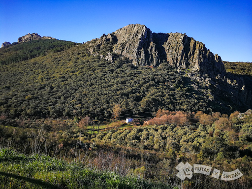
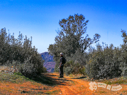
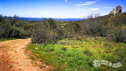
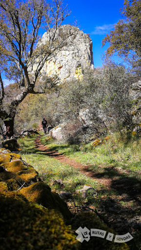
Las Villuercas vuelven a sorprendernos en esta pintoresca ruta entre sus accidentes geográficos con numerosos alicientes, entre los que se encuentran varios valles, una cueva y una última subida a los restos de un castillo desde el que podemos contemplar fascinantes panorámicas.
Más información en el siguiente vídeo y en:
https://derutasysendas.com/index.php/2019/05/14/navezuelas-cabanascastillo/
- - - - - - - - - - - - - - -- - - - - - - - - - - - - - - -
► SUSCRÍBETE PARA MÁS VÍDEOS
- - - - - - - - - - - - - - -- - - - - - - - - - - - - - - - -
►SÍGUENOS en las REDES SOCIALES:
FACEBOOK
INSTAGRAM
TWITTER
- - - - - - - - - - - - - - -- - - - - - - - - - - - - - - - -
► BLOG
Las Villuercas vuelven a sorprendernos en esta pintoresca ruta entre sus accidentes geográficos con numerosos alicientes, entre los que se encuentran varios valles, una cueva y una última subida a los restos de un castillo desde el que podemos contemplar fascinantes panorámicas.
Más información en el siguiente vídeo y en:
https://derutasysendas.com/index.php/2019/05/14/navezuelas-cabanascastillo/
- - - - - - - - - - - - - - -- - - - - - - - - - - - - - - -
► SUSCRÍBETE PARA MÁS VÍDEOS
- - - - - - - - - - - - - - -- - - - - - - - - - - - - - - - -
►SÍGUENOS en las REDES SOCIALES:
- - - - - - - - - - - - - - -- - - - - - - - - - - - - - - - -
► BLOG
Waypoints
 Waypoint
 2,975 ft
Inicio de Navezuelas Excursionismo
martes 27 de marzo de 2018 10:53 CEST
Elevación: 907 m
Waypoint
2,434 ft
Fin de Navezuelas Excursionismo
martes 27 de marzo de 2018 17:09 CEST
Elevación: 742 m
 Geocache
0 ft
Geocache
0 ft
APRETURAS del RÍO ALMONTE

 Panorama
0 ft
Panorama
0 ft
MIRADOR de las APRETURAS del RÍO ALMONTE
 Cave
0 ft
Cave
0 ft
CUEVA del CANCHO HURRACO
 Waypoint
0 ft
Waypoint
0 ft
COLLADO de las CARRETAS
 Intersection
0 ft
Intersection
0 ft
DESVÍO
 Bridge
0 ft
Bridge
0 ft
PUENTE de la PASADERA
 Waypoint
0 ft
Waypoint
0 ft
MANANTIAL del CORCHITO
Waypoint
0 ft
COLLADO de los ZAHURDONES
 Birding spot
0 ft
Birding spot
0 ft
PEÑA BUITRERA
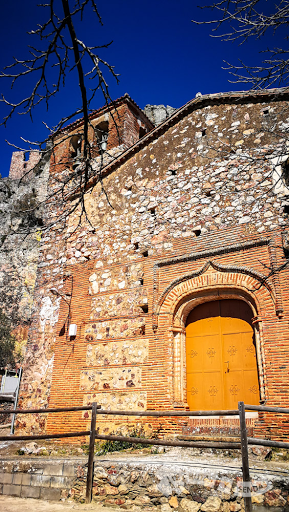
 Religious site
0 ft
Religious site
0 ft
IGLESIA VIRGEN de la PEÑA
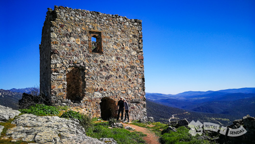
 Castle
0 ft
Castle
0 ft
CASTILLO de CABAÑAS del CASTILLO
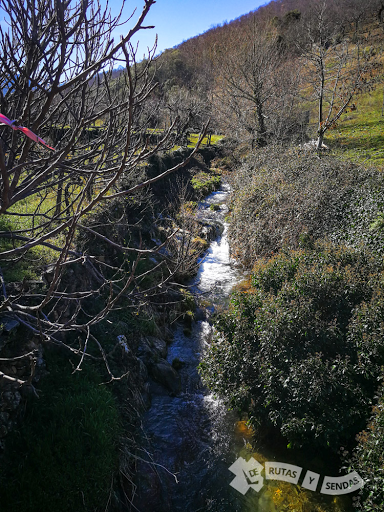
 River
0 ft
River
0 ft
PASO por el RÍO ALMONTE
You can add a comment or review this trail
Comments