
PILONES DE ALLEPUZ A VILLARROYA DE LOS PINARES
Trail photos


Author

Trail stats
- Distance
- 5.13 mi
- Elevation gain
- 505 ft
- Technical difficulty
- Easy
- Elevation loss
- 840 ft
- Max elevation
- 5,003 ft
- TrailRank
- 41
- Min elevation
- 4,165 ft
- Trail type
- One Way
- Time
- 2 hours 47 minutes
- Coordinates
- 801
- Uploaded
- April 16, 2023
- Recorded
- April 2023
near Allepuz, Aragón (España)
Viewed 101 times, downloaded 2 times
Trail photos
Itinerary description
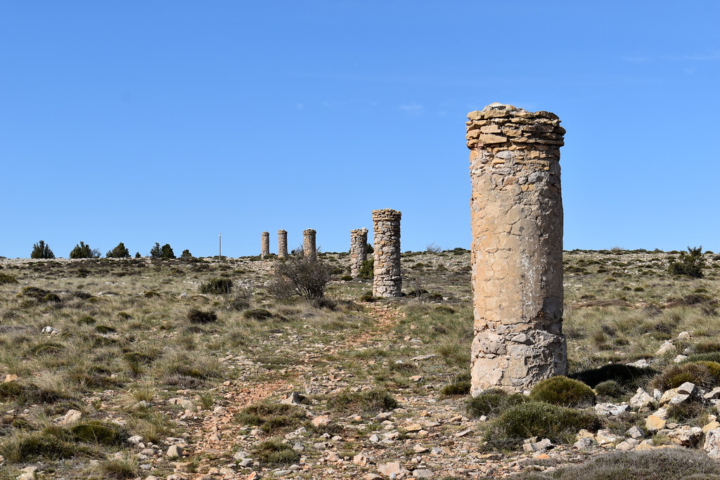
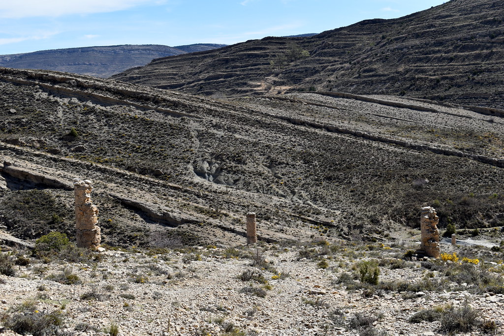
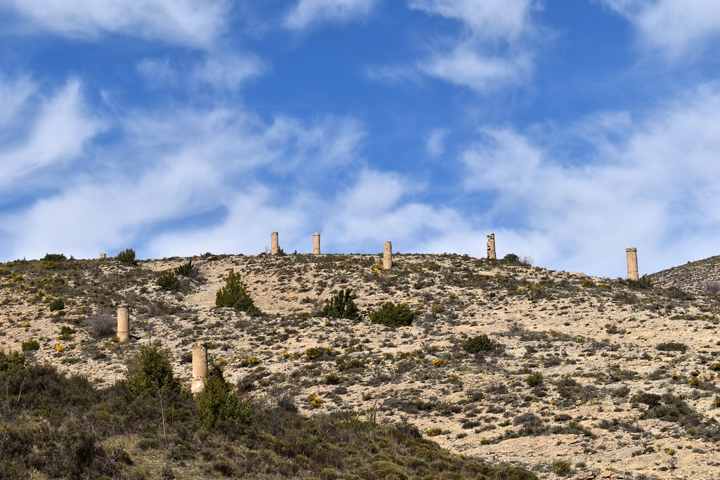
Es un itinerario muy curioso porque se encuentra jalonado con más de cien pilones de piedra, construidos en el siglo XVIII, que servían para orientarse en época de nieves y entre las frecuentes nieblas a esta altitud. El camino está declarado Bien de Interés Cultural (BIC). Se conoce también como Camino de Jaime I porque se tiene constancia de que este rey lo recorrió en algunas ocasiones marchando hacia la conquista de Valencia.
Antes de empezar en Allepuz, hemos dejado otro coche en Villarroya de los Pinares, a 10 minutos, así nos ahorramos la vuelta por el mismo camino.
Son las 9.30 de la mañana, dejamos el coche junto a la iglesia de la Purificación.


Trinquete.

Señalización.

Peirón o Humilladero de San Cristóbal.

Y ya los tenemos a la vista.
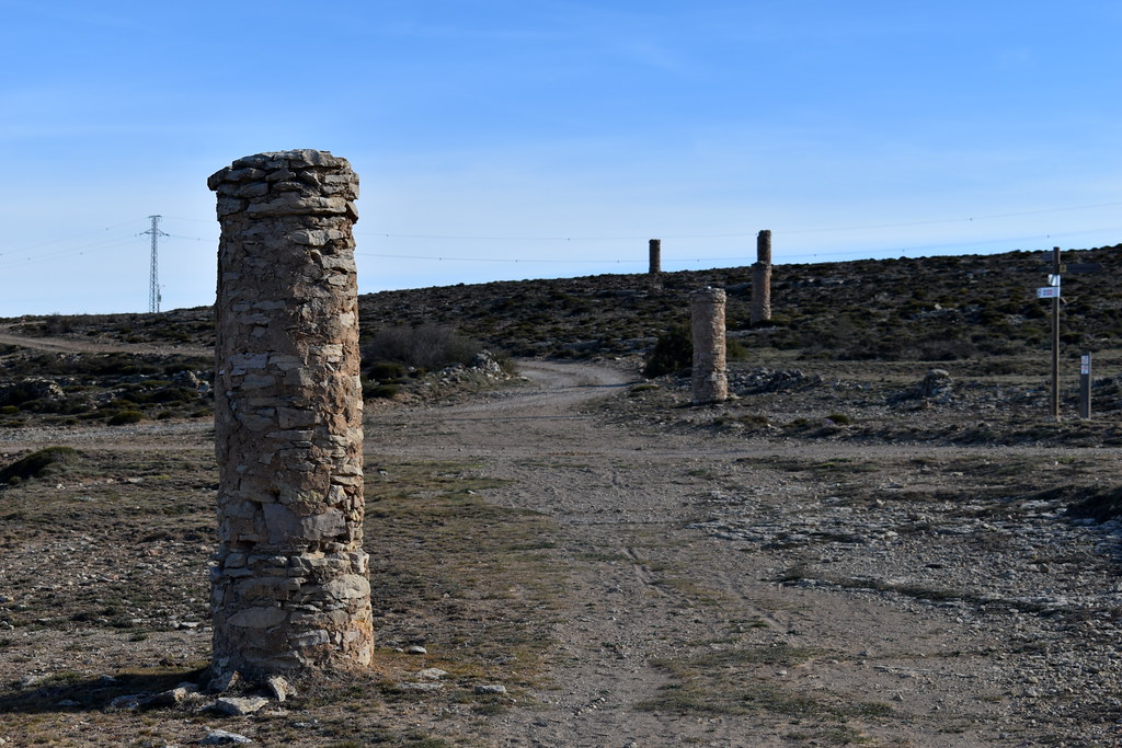


Una pena, algunos ya están casi destruídos.

Seguimos.


Este también, en malas condiciones.

Si te fijas, se ve un abrevadero, ojo que si te despistas charlando, es fácil saltarse el desvío.
Ahí está el abrevadero.

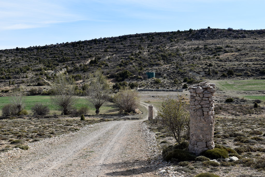
Vamos cogiendo altura.


Este inclinado...

Y este con abrigo, que hace frío...


Cruzamos la pista.


Aquí también cruzamos otro camino.


En alguna época que haya rebaños, he leído que puede haber mastines, en ese caso alejarse del rebaño para evitar problemas y sustos.


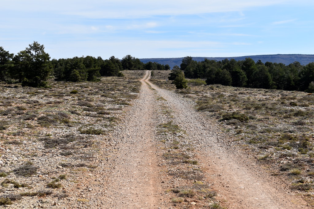
Esta parte es muy bonita, por bosque y vistas muy chulas.


Nosotros aquí por la derecha, parece que dejamos la zona que puede haber rebaños y mastines.


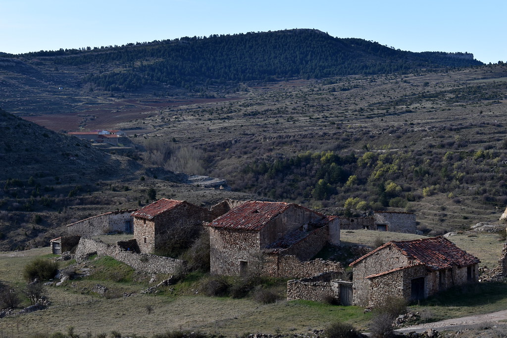
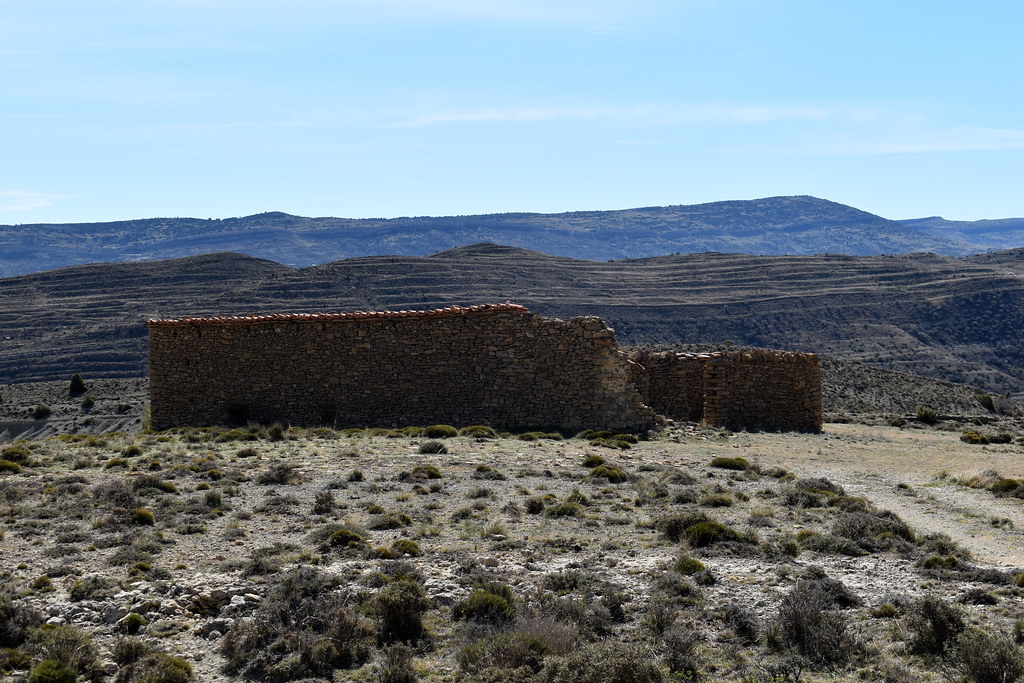
Pasamos junto a un antíguo corral.


A nuestra izquierda montañas.

Aquí tenemos el aserradero a la vista, nos empezó a ladrar un perro, pero está dentro de las instalaciones y no hay peligro.


Fuente/Manantial.

Pasamos junto a la carpintería.


Último pilón.

Cruzamos la carretera al otro lado.


El camino no está muy claro pero no hay duda.

Aquí torcemos a derecha...

para cruzar el arroyo.

Ya tenemos el pueblo a la vista.

Ayuntamiento de Villarroya de los Pinares.

Con su plaza.

Ahí a la derecha tenemos un bar para tomar algo.

Y hacia las 12:15 damos la ruta por terminada.

Antes de empezar en Allepuz, hemos dejado otro coche en Villarroya de los Pinares, a 10 minutos, así nos ahorramos la vuelta por el mismo camino.
Son las 9.30 de la mañana, dejamos el coche junto a la iglesia de la Purificación.
Trinquete.
Señalización.
Peirón o Humilladero de San Cristóbal.
Y ya los tenemos a la vista.
Una pena, algunos ya están casi destruídos.
Seguimos.
Este también, en malas condiciones.
Si te fijas, se ve un abrevadero, ojo que si te despistas charlando, es fácil saltarse el desvío.
Ahí está el abrevadero.
Vamos cogiendo altura.
Este inclinado...
Y este con abrigo, que hace frío...
Cruzamos la pista.
Aquí también cruzamos otro camino.
En alguna época que haya rebaños, he leído que puede haber mastines, en ese caso alejarse del rebaño para evitar problemas y sustos.
Esta parte es muy bonita, por bosque y vistas muy chulas.
Nosotros aquí por la derecha, parece que dejamos la zona que puede haber rebaños y mastines.
Pasamos junto a un antíguo corral.
A nuestra izquierda montañas.
Aquí tenemos el aserradero a la vista, nos empezó a ladrar un perro, pero está dentro de las instalaciones y no hay peligro.
Fuente/Manantial.
Pasamos junto a la carpintería.
Último pilón.
Cruzamos la carretera al otro lado.
El camino no está muy claro pero no hay duda.
Aquí torcemos a derecha...
para cruzar el arroyo.
Ya tenemos el pueblo a la vista.
Ayuntamiento de Villarroya de los Pinares.
Con su plaza.
Ahí a la derecha tenemos un bar para tomar algo.
Y hacia las 12:15 damos la ruta por terminada.

Waypoints
 Waypoint
 4,650 ft


You can add a comment or review this trail
Comments