
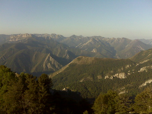
Subida Tiatordos
Trail photos


Author

Trail stats
- Distance
- 9.54 mi
- Elevation gain
- 3 ft
- Technical difficulty
- Moderate
- Elevation loss
- 3 ft
- Max elevation
- -1,371 ft
- TrailRank
- 20
- Min elevation
- -1,371 ft
- Trail type
- One Way
- Coordinates
- 2699
- Uploaded
- September 22, 2010
- Recorded
- September 2010
near Pendones, Asturias (España)
Viewed 1355 times, downloaded 33 times
Trail photos
Itinerary description
Waypoints
 Waypoint
 -2,513 ft
Start
Start point of track Subida Tiatordos
Latitude: 43° 9' 1.0" N
Longitude: 5° 15' 10.0" W
Time: 21.09.2010 / 05:19:24 GMT
Waypoint
-2,595 ft
End
Finish point of track Subida Tiatordos
Latitude: 43° 8' 53.0" N
Longitude: 5° 15' 29.0" W
Time: 21.09.2010 / 12:51:50 GMT
Waypoint
-5,092 ft
Waypoint of track 'Subida Tiatordos'
01-Vista desde las majadas del Tiatordos
Latitude: 43° 10' 12.0" N
Longitude: 5° 13' 52.0" W
Time: 21.09.2010 / 07:31:32 GMT
Waypoint
-5,761 ft
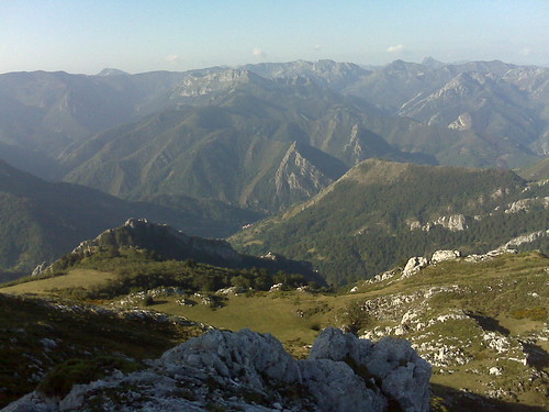
Waypoint of track 'Subida Tiatordos'
02 - Vista subiendo por la arista
Latitude: 43° 10' 33.0" N
Longitude: 5° 13' 40.0" W
Time: 21.09.2010 / 08:19:29 GMT
Waypoint
-6,522 ft
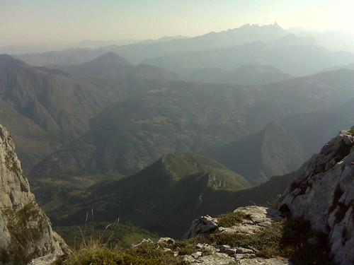
Waypoint of track 'Subida Tiatordos'
04 - Vista desde lo alto de Tiatordos del valle de Ponga
Latitude: 43° 10' 30.0" N
Longitude: 5° 13' 19.0" W
Time: 21.09.2010 / 09:02:02 GMT
Waypoint
-6,578 ft
Waypoint of track 'Subida Tiatordos'
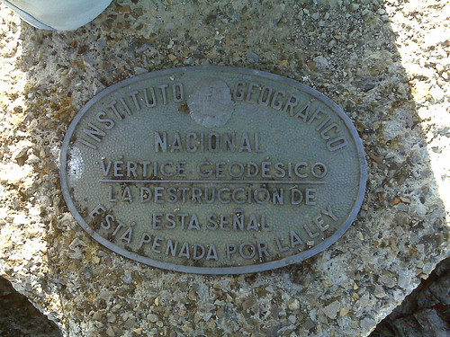
05 - Vértice geodésico
Latitude: 43° 10' 27.0" N
Longitude: 5° 13' 13.0" W
Time: 21.09.2010 / 09:09:07 GMT
Waypoint
-4,783 ft
Waypoint of track 'Subida Tiatordos'
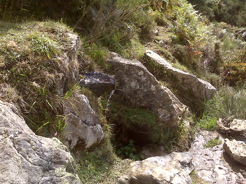
07-Manantial en la majada Pláganu
Latitude: 43° 10' 4.0" N
Longitude: 5° 13' 45.0" W
Time: 21.09.2010 / 11:21:22 GMT
Waypoint
0 ft
Photo of track 'Subida Tiatordos'
Latitude: 43° 10' 4.0" N
Longitude: 5° 13' 45.0" W
Time: 21.09.2010 / 11:21:04 GMT
Waypoint
0 ft
Photo of track 'Subida Tiatordos'
Latitude: 43° 10' 27.0" N
Longitude: 5° 13' 14.0" W
Time: 21.09.2010 / 09:08:49 GMT
Waypoint
0 ft
Photo of track 'Subida Tiatordos'
Latitude: 43° 10' 30.0" N
Longitude: 5° 13' 19.0" W
Time: 21.09.2010 / 09:01:43 GMT
Waypoint
0 ft
Photo of track 'Subida Tiatordos'
Latitude: 43° 10' 33.0" N
Longitude: 5° 13' 40.0" W
Time: 21.09.2010 / 08:19:08 GMT
Waypoint
0 ft
Photo of track 'Subida Tiatordos'
Latitude: 43° 10' 12.0" N
Longitude: 5° 13' 53.0" W
Time: 21.09.2010 / 07:30:31 GMT
You can add a comment or review this trail
Comments