
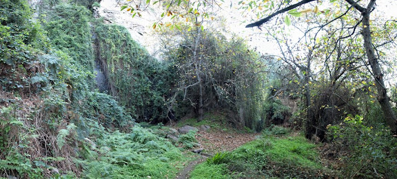
Tenerife. Barranco de Ruíz
Trail photos


Author

Trail stats
- Distance
- 6.14 mi
- Elevation gain
- 1,909 ft
- Technical difficulty
- Moderate
- Elevation loss
- 1,942 ft
- Max elevation
- 2,203 ft
- TrailRank
-
70
 3.8
3.8
- Min elevation
- 423 ft
- Trail type
- Loop
- Time
- 3 hours one minute
- Coordinates
- 819
- Uploaded
- December 22, 2008
- Recorded
- December 2008
near Las Aguas, Canarias (España)
Viewed 42379 times, downloaded 1328 times
Trail photos
Itinerary description

Waypoints
 Waypoint
 1,491 ft
Seguir izq.
21-DIC-08 10:37:51
Waypoint
1,526 ft
Bajada Bco.
21-DIC-08 10:19:38
Waypoint
2,182 ft
Carretera
21-DIC-08 11:34:08
Waypoint
1,624 ft
Carretera2
21-DIC-08 11:58:59
Waypoint
1,736 ft
Cascada
21-DIC-08 11:03:32
Waypoint
1,526 ft
cruce
21-DIC-08 10:19:08
Waypoint
1,404 ft
La Vera
21-DIC-08 10:10:37
Waypoint
436 ft
PUENTE RUIZ
PUENT RUIZ
Waypoint
1,772 ft
SEGUIR DER.
21-DIC-08 11:15:35
Waypoint
1,814 ft
SEGUIR DER.2
21-DIC-08 11:16:26
Waypoint
2,008 ft
SEGUIR DER.3
21-DIC-08 11:22:22
Waypoint
0 ft
Seguir Der.4
Camino
Waypoint
2,044 ft
Senda Recto
21-DIC-08 11:41:51
Waypoint
1,541 ft
VERA BAJA
VERA BAJA
Comments (8)
You can add a comment or review this trail
I have followed this trail View more
Information
Easy to follow
Scenery
Easy
Facil y preciosa ruta
I have followed this trail View more
Information
Easy to follow
Scenery
Moderate
muy buena ruta al principio un poco fuerte la subida pero ya luego se hace mas llevadera
This is one of the most beautyfull walks a beginner can make on Tenerife!!! Only in the start a little dangerous but once in the valley it's a dream !! I will once again be on Tenerife as from sept 10th 2014 until end of october 2014!!!
El recorrido esta bien a la sombra buena parte del recorrido pero....debido a desprendimientos la mitad del trayecto esta cerrado con unas vallas que si bien estan rotas advierten del peligro que es bastante real por cierto, seria a partir del pueblo al que se llega por una carretera sin arcen muy transitada.Debido al poco uso del sendero se asemeja a la selva amazonica.Por lo demas es una ruta variopinta y bella
I have followed this trail verified View more
Information
Easy to follow
Scenery
Moderate
Very nice trek but part of the route has been closed of due to danger
I have followed this trail View more
Information
Easy to follow
Scenery
Moderate
Muy bonito sendero, con zonas que ayudan a desconectar.
I have followed this trail View more
Information
Easy to follow
Scenery
Easy
Ruta bastante pintoresca. Corta pero muy entretenida. Un 7 le doy.
Hola. Imposible hacer la ruta completa. A fecha de hoy sendero cortado en la bajada al barranco desde Icod Alto. Hay una valla. Hay que volver por el camino de subida.