
VÉRTICE ANAYET. CIRCULAR POR LA GLERA Y EL BARRANCO DE CULIVILLAS.
Trail photos


Author

Trail stats
- Distance
- 7.25 mi
- Elevation gain
- 2,825 ft
- Technical difficulty
- Moderate
- Elevation loss
- 2,759 ft
- Max elevation
- 8,366 ft
- TrailRank
-
68
 5
5
- Min elevation
- 5,646 ft
- Trail type
- One Way
- Time
- 6 hours 47 minutes
- Coordinates
- 1358
- Uploaded
- January 5, 2018
- Recorded
- January 2018
near El Portalet, Aragón (España)
Viewed 2308 times, downloaded 180 times
Trail photos
Itinerary description
La he puesto como moderada porque había mucha nieve y sobre todo la última parte de la subida al Vértice ha sido bastante costosa.
Hemos salido desde Formigal-Anayet. El riesgo de alud estaba en 3, por lo que hemos decidido evitar el barranco de Culivillas y subir por la Glera.
Subida muy pronunciada por el lateral de las pistas.


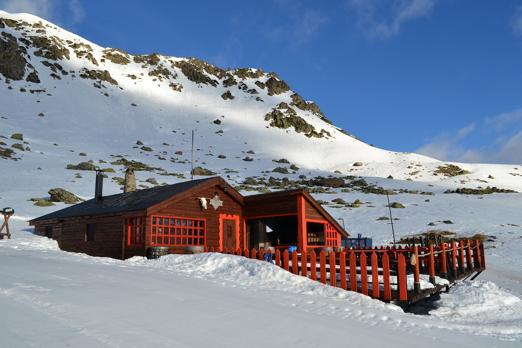
Paso por el restaurante
, y poco a poco nos juntamos con la subida del barranco.


Ya estamos en el ibón.


A partir de aquí con crampones. Había muchísima nieve y estaba un poco blanda, pero se subía mejor con crampones que con raquetas.


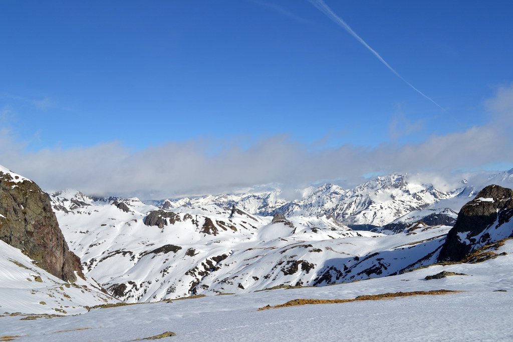

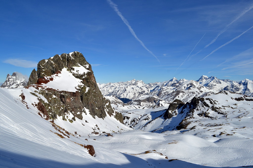
Desde la cima, vistas espectaculares.


Bajada por el mismo camino hasta pasado el ibón.


Como a la subida hemos visto bastante gente subiendo por el barranco, y en las paredes no se veía mucha nieve acumulada, hemos decidido bajar por el barranco de Culivillas. Ningún problema.


La última parte, bajada por el lateral de las pistas.


Hemos salido desde Formigal-Anayet. El riesgo de alud estaba en 3, por lo que hemos decidido evitar el barranco de Culivillas y subir por la Glera.
Subida muy pronunciada por el lateral de las pistas.
Paso por el restaurante
, y poco a poco nos juntamos con la subida del barranco.
Ya estamos en el ibón.
A partir de aquí con crampones. Había muchísima nieve y estaba un poco blanda, pero se subía mejor con crampones que con raquetas.
Desde la cima, vistas espectaculares.
Bajada por el mismo camino hasta pasado el ibón.
Como a la subida hemos visto bastante gente subiendo por el barranco, y en las paredes no se veía mucha nieve acumulada, hemos decidido bajar por el barranco de Culivillas. Ningún problema.
La última parte, bajada por el lateral de las pistas.

Waypoints
 Waypoint
 0 ft
0 ft


Comments (1)
You can add a comment or review this trail
I have followed this trail verified View more
Information
Easy to follow
Scenery
Moderate
Moltes gràcies per compartir la ruta. Avui hem seguit una part d'aquesta ruta. Hem pujat i baixat pel barranc de Culivillas ja que la neu a primera hora estava dura i era fàcil fer al camí, al migdia ja hem trobat algun pont de neu més trencat i la neu molt tova. Hem fet la variant de pujar pel coll d'Anayet, ja que voliem mirar si hi havia traça oberta per pujar al cim i al final hem fet els dos cims. Per on vas pujar tu per fer el vertice l'hem fet de baixada i cap problema. Fins aviat!