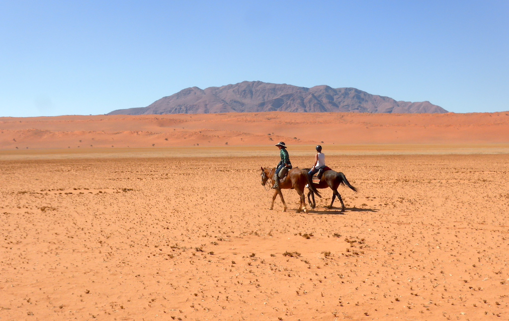
Horseback Riding

The Best Horseback Riding Trails in the World

981 trails

(16)
Photo of Tsaatan Land Photo of Explore the gauchos’ route to the Nef Glacier Photo of La Blanquita (Frontino)-Quiparadó-Vásquez-El Puente-El Sireno (Urrao)
  • Tsaatan Land

    Horseback Riding
    Save to a List
    near Tsagaannuur, Хөвсгөл Аймаг (Mongol Uls)
    Distance
    61.10mi
    Elevation +
    9101f
    TrailRank
    68| Rating 4.0
    Photo ofTsaatan Land Photo ofTsaatan Land Photo ofTsaatan Land

    Loop in Mongolia to meet the Tsaatan people at the border with Siberia. This is commonly done on horseback, due also to the presence of long stretches inside swamps which would pose problems to ordinary walking. Be sur...

    Mis felicitaciones, fantástica ruta. Bellos paisajes.
    Mr Hunter
    Good!
    Ines.017
  • Explore the gauchos’ route to the Nef Glacier

    Horseback Riding
    Save to a List
    near Puerto Bertrand, Aisén (Chile)
    Distance
    51.07mi
    Elevation +
    2349f
    TrailRank
    36
    Photo ofExplore the gauchos’ route to the Nef Glacier Photo ofExplore the gauchos’ route to the Nef Glacier Photo ofExplore the gauchos’ route to the Nef Glacier

    Come face to face with the Nef Glacier, part of the Northern Patagonia Ice Fields, during this three-day trip that combines navegation, hiking, horse trekking and camping at an old gaucho outpost, complete with a traditi...

  • near Murrí, Departamento de Antioquia (Republic of Colombia)
    Distance
    56.07mi
    Elevation +
    7713f
    TrailRank
    99| Rating 5.0
    Photo ofLa Blanquita (Frontino)-Quiparadó-Vásquez-El Puente-El Sireno (Urrao) Photo ofLa Blanquita (Frontino)-Quiparadó-Vásquez-El Puente-El Sireno (Urrao) Photo ofLa Blanquita (Frontino)-Quiparadó-Vásquez-El Puente-El Sireno (Urrao)

    RUTA DE LAS LENTEJAS ROSADAS GOURMET Travesía a Caballo La Blanquita (Frontino) - El Sireno (Urrao) 19, 20, 21 y 22 de julio de 2016 La idea de ésta fascinante travesía de 90 km a caballo por el Chocó biogeográfico;...

    Se ve increible, esta ruta. Ojala pueda hacerla algún día
    Alejandro Lopez Toro
    Maravillosa ruta, pero en verano
    Luis Quiceno
    Gracias Monja Voladora por compartir esta super aventura, que como otras, lo dejan a uno con la motivación para recorrer...
    liliwhale®
  • Mountains of Gold (Naryn Region)

    Horseback Riding
    Save to a List
    near Eki-Naryn, Naryn (Kyrgyz Republic)
    Distance
    65.29mi
    Elevation +
    11490f
    TrailRank
    21
    Photo ofMountains of Gold (Naryn Region)

    Choose this loop route for an array of experiences in Naryn's varied landscapes. Look for rare deer in the Bugulu-Tör Valley, pristine natural beauty in the Kichi Kashka-Suu Gorge, and observe an active gold mining opera...

  • Weather Forecast

    A great hint to help you choose your outdoor gear and clothing!

    Get Wikiloc Premium Upgrade to remove Ads
    Weather Forecast Weather Forecast
  • Shepherd's Life (Naryn Region)

    Horseback Riding
    Save to a List
    near Eki-Naryn, Naryn (Kyrgyz Republic)
    Distance
    50.87mi
    Elevation +
    6713f
    TrailRank
    20
    Photo ofShepherd's Life (Naryn Region)

    Get a taste of the shepherd's life on this extended horse trek through remote jailoo mountain pastures, passing authentic yurt camps and a small glacial lake on the way. This route is an excellent choice for those lookin...

  • Nomads' Home (Naryn Region)

    Horseback Riding
    Save to a List
    near Besh-Belchir, Naryn (Kyrgyz Republic)
    Distance
    63.58mi
    Elevation +
    8688f
    TrailRank
    20
    Photo ofNomads' Home (Naryn Region)

    Experience rural life and the hospitality of shepherds along this route, the visual highlight of which is Köl-Tör lake's cerulean glacial melt waters at 3080m. On the penultimate day of the trek, enjoy the incredible vie...

  • near Berga, Catalunya (España)
    Distance
    61.19mi
    Elevation +
    10568f
    TrailRank
    76| Rating 4.84
    Photo ofVilaforniu - Avià - Espunyola - Vall D'Ora - Bonner - Peguera Photo ofVilaforniu - Avià - Espunyola - Vall D'Ora - Bonner - Peguera Photo ofVilaforniu - Avià - Espunyola - Vall D'Ora - Bonner - Peguera

    Ruta a cavall de tres dies que segueix el traçat proposat per La Ruta del Caracremada, tot i que conté alguna modificació sigui per fer-la més curta o adequada a cavalls, o sigui perquè el traçat proposat era impracticab...

    Bel tour, belle foto, bravi!!!
    Filippototo
    La descripció dels trams es molt ajustada a la realitat. Una ruta per gaudir del paisatge i dels cavalls
    Thorsempre
  • Pastoral Lands (Naryn Region)

    Horseback Riding
    Save to a List
    near Besh-Belchir, Naryn (Kyrgyz Republic)
    Distance
    81.82mi
    Elevation +
    7799f
    TrailRank
    17
    Photo ofPastoral Lands (Naryn Region)

    Trek along jailoo mountain valleys where traditional pastoral ways of life live on – stopping along the way to accept offers of national food and drink. Panoramic views of the Burul-Aigyr Pass are the scenic highlight, b...

  • Camel riding

    Horseback Riding
    Save to a List
    near Nabq, Janūb Sīnāʼ (Egypt)
    Distance
    64.18mi
    Elevation +
    3376f
    TrailRank
    16

    Bus transfer and Camel Riding at the bedouins on Sinai peninsula Total points: 2251, Total time: 06:20:46, Distance: 104.798Km

  • Kel-Suu Lake Loop (Naryn Region)

    Horseback Riding
    Save to a List
    near Uzgorysh, Naryn (Kyrgyz Republic)
    Distance
    99.05mi
    Elevation +
    10049f
    TrailRank
    15

    Incomparable Kol-Suu Lake, one of the highlights of the entire country, serves as the focal point of this horse trekking route deep into the mountains of Naryn. Celestial mountains, herds of free-roaming horses, and a wi...

  • Glacier National Park

    Horseback Riding
    Save to a List
    near Summit, Montana (United States)
    Distance
    86.82mi
    Elevation +
    10817f
    TrailRank
    14

    The Continental Divide Trail (CDT) in Glacier National Park is 116 miles long. When trails get this long they are better represented by waypoints rather than track points. Each waypoint label contains a trail section num...

  • Corumi a Santa Bárbara

    Horseback Riding
    Save to a List
    near Conjunto Taquaril, Minas Gerais (Brazil)
    Distance
    55.76mi
    Elevation +
    4495f
    TrailRank
    64
    Photo ofCorumi a Santa Bárbara Photo ofCorumi a Santa Bárbara Photo ofCorumi a Santa Bárbara

    Partindo da Hípica Corumi, região leste de BH, seguimos a cavalo por Raposos, Morro Vermelho, Caeté, Barão de Cocais até Santa Bárbara. Durante o percurso, predkminantemente em estrada de terra de excelente piso, cruzamo...

  • De Norte a Sur - Ramal del Maestrazgo

    Horseback Riding
    Save to a List
    near Morella, Valencia (España)
    Distance
    87.22mi
    Elevation +
    12835f
    TrailRank
    63
    Photo ofDe Norte a Sur - Ramal del Maestrazgo Photo ofDe Norte a Sur - Ramal del Maestrazgo Photo ofDe Norte a Sur - Ramal del Maestrazgo

    Ruta a caballo de 141 km desde Morella en Els Ports hasta Mosqueruela en la Sierra de Gudar, pasando por Olocau del Rey, Cantavieja, Fortanete yValdelinares. Salimos de Morella, 6 jinetes, Luis y Maria de Calanda, Juan ...

  • Along the Silk Road (Naryn Region)

    Horseback Riding
    Save to a List
    near Ak-Beyit, Naryn (Kyrgyz Republic)
    Distance
    70.36mi
    Elevation +
    10125f
    TrailRank
    12

    Head off the beaten track and into the high and rocky Kalkagar Mountains, with fantastic mountain views and occasional glimpses of nomadic life. Continue past Torpo Lake and panoramic views of the Ak-Talaa valley's sandy...

  • Prades La LLacuna per La Riba i Pont d'Armentera

    Horseback Riding
    Save to a List
    near Prades, Catalunya (España)
    Distance
    56.85mi
    Elevation +
    7874f
    TrailRank
    61
    Photo ofPrades La LLacuna per La Riba i Pont d'Armentera Photo ofPrades La LLacuna per La Riba i Pont d'Armentera Photo ofPrades La LLacuna per La Riba i Pont d'Armentera

    Es tracta d’una ruta lineal de tres dies que realitzem una mitjana de 10 cavalls. En general, no presenta massa dificultats tret de les descrites concretament en el text següent: 1r dia: Prades- Refugi dels Masets (La...

  • De Norte a Sur - Ramal de Bétera

    Horseback Riding
    Save to a List
    near La Mallá, Valencia (España)
    Distance
    54.60mi
    Elevation +
    10689f
    TrailRank
    55
    Photo ofDe Norte a Sur - Ramal de Bétera Photo ofDe Norte a Sur - Ramal de Bétera Photo ofDe Norte a Sur - Ramal de Bétera

    Salimos de las cuadras de Rafi y Merche en Les Llomes de Bétera hacia Portacelli donde cogimos la senda de la Cañada Fría hacia el Barranc de Rubio, seguimos la pista para subir por el Barranc de Pedralbilla hasta la Fon...

  • De Norte a Sur - Ramal de Ribarroja

    Horseback Riding
    Save to a List
    near Ribarroja, Valencia (España)
    Distance
    60.33mi
    Elevation +
    8766f
    TrailRank
    55
    Photo ofDe Norte a Sur - Ramal de Ribarroja Photo ofDe Norte a Sur - Ramal de Ribarroja Photo ofDe Norte a Sur - Ramal de Ribarroja

    Salimos de las cuadras de Pascual en Ribarroja del Turía a coger la Vereda Real en dirección al río Turia para remontarlo por la senda fluvial hacia Vilamarxant, pasamos varios puentes sobre el río y paramos a tomar un t...

  • Val d'Hérens Suissa 21-25 agost 2023

    Horseback Riding
    Save to a List
    near Vex, Canton du Valais (Switzerland)
    Distance
    62.12mi
    Elevation +
    14419f
    TrailRank
    54
    Photo ofVal d'Hérens Suissa 21-25 agost 2023 Photo ofVal d'Hérens Suissa 21-25 agost 2023 Photo ofVal d'Hérens Suissa 21-25 agost 2023

    Ruta realitzada per els Cowboys de la Selva els dies 21 a 25 d’agost de 2023. Començem la ruta al Ranch Maragnènes (https://maragnene.ch), on dormim el dia 20 que arribem amb força calor per l’època de l’any. Sortim del ...

  • near Castrovido, Castilla y León (España)
    Distance
    92.17mi
    Elevation +
    11004f
    TrailRank
    52
    Photo ofEntre DOS mares - Ramal de Cuzcurrita de río Tirón Photo ofEntre DOS mares - Ramal de Cuzcurrita de río Tirón Photo ofEntre DOS mares - Ramal de Cuzcurrita de río Tirón

    Ruta a caballo de 150 km, desde Castrovido en Burgos (enlace con la ruta Entre DOS mares desde el Mediterraneo al Cantábrico) cruzando la Sierra de la Demanda por Barbadillo de Herreros a Valgañón, Santurde de Rioja y Cu...

  • Ruta ecuestre por Sierra Morena

    Horseback Riding
    Save to a List
    near Alcolea, Andalucía (España)
    Distance
    85.11mi
    Elevation +
    12585f
    TrailRank
    50
    Photo ofRuta ecuestre por Sierra Morena Photo ofRuta ecuestre por Sierra Morena Photo ofRuta ecuestre por Sierra Morena

    Ruta ecuestre que recorre la Sierra Morena Cordobesa oriental y la Sierra Morena Jiennense occidental. ETAPA 1: Puente Mocho - Villafranca de Córdoba - Adamuz ETAPA 2: Adamuz - Montoro - Ermita Virgen de la Fuensanta...

  • La Felguerina - Maraña - Brañagallones

    Horseback Riding
    Save to a List
    near La Felguerina, Asturias (España)
    Distance
    67.54mi
    Elevation +
    13986f
    TrailRank
    49| Rating 5.0
    Photo ofLa Felguerina - Maraña - Brañagallones Photo ofLa Felguerina - Maraña - Brañagallones Photo ofLa Felguerina - Maraña - Brañagallones

    Tramos extremos..no aptos para caballos que no tienen experiencia en la montaña. Muy recomendado contratar guía "Cabalgando sueños", grandes profesionales y tremenda compañía.

    Buena ruta pero muy dura y difícil de realizar sin Caballos acostumbrados a la alta montaña.. en algunos puntos exige ir...
    Eladio Rico 1
    La ruta magnifica, pero exigente, pura montaña.
    Candido Cabana
  • Ruta por Extremadura.

    Horseback Riding
    Save to a List
    near Mérida, Extremadura (España)
    Distance
    63.48mi
    Elevation +
    3186f
    TrailRank
    48
    Photo ofRuta por Extremadura. Photo ofRuta por Extremadura. Photo ofRuta por Extremadura.

    RUTA DETALLADA 1. Iniciamos la ruta, avanzando 20 metros una vez salgamos de las cuadras. 2. Giramos a la derecha. 3. Avanzamos 450, y cruzamos la carretera. 4. Giramos a la izquierda. 5. Continuamos tod...

3D Maps

Experience trails in vivid detail, from summits to valleys. Embark on a virtual route for a realistic 3D view.

Get Wikiloc Premium Upgrade to remove Ads
3D Maps 3D Maps